
Agusan del Sur is a landlocked province bounded on the North by Agusan del Norte, on the east by Surigao del Sur, the south by Davao del Norte, an on west by Misamis Oriental and Bukidnon. It is situated in the Northern Mindanao within the grid square of 7055’57” - 9000’ latitude and 125015’ - 126015’ longitude. It can be reached by land through Davao – Butuan National Highway.
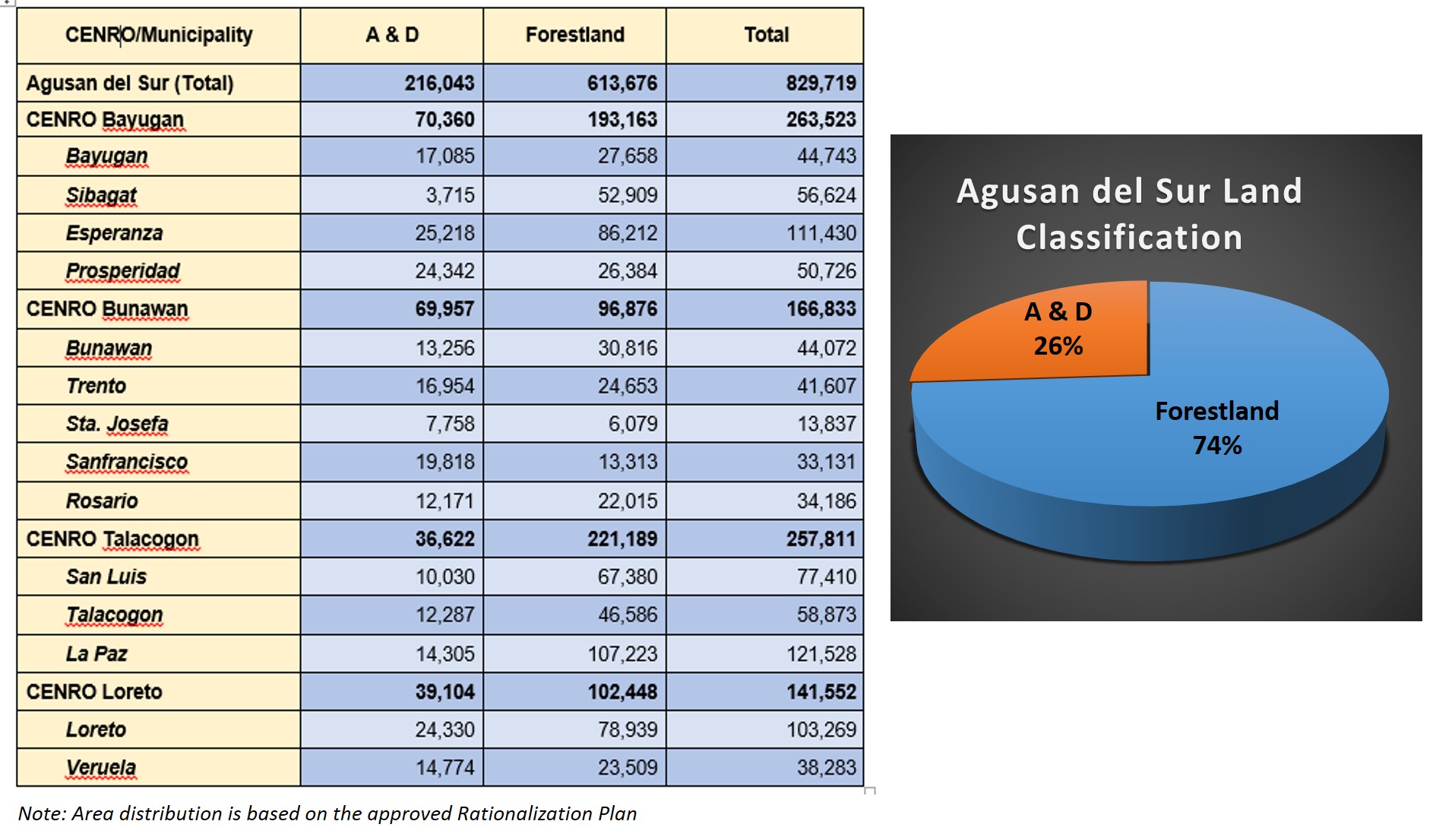
The province has an aggregate area of 829,719 hectares with a certified Alienable & Disposable (A & D) land area 216,043 hectares and 613,676 hectares classified as forestland. It covers thirteen (13) municipalities and one (1) component city consisting of 318 barangays within the two (2) Districts of Agusan del Sur.
It falls within climatic type II which is characterized by very pronounced rainfall with no distinct dry season.
Visayan is the most widely used dialect using Cebuano as the main discourse. Considering its rich natural resources and vast agricultural lands, migrants from far-off and neighboring provinces are lured to settle in the province. Farming is the principal means of livelihood.
Provincial Environment and Natural Resources Office (PENRO) – Agusan del Sur is based at the Government Center of Patin-ay, Prosperidad, Agusan del Sur. Just this year, from its five (5) Community Environment and Natural Resources Offices (CENRO) it became four (4) which are strategically located at the municipalities of Bayugan, Bunawan, Loreto and Talacogon. CENRO San Francisco was abolished due to the implementation of the DENR’s Rationalization Plan. The table and graph below shows the land classification of the area of responsibility of each CENRO and the percentage of land classification of the province.
PENRO Agusan del Sur